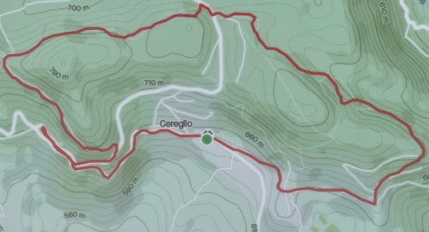
PINK RUN 5,5KM +150 -150
Departure from the Totem Fontana in the town center towards Casa Maldina. The next points will be
the crossroads for Tolè where you take the panoramic road to get to the Sette Croci. Continuing
towards Serretto, along the Vita route to get to Sant'Antonio, Suzzano and finally return to the
starting point.
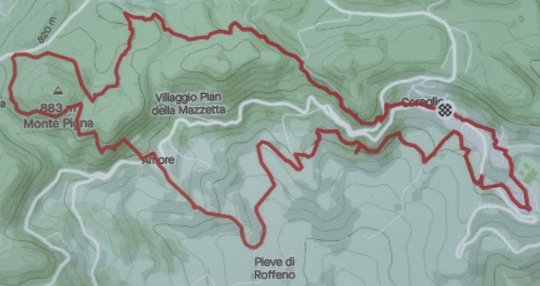
BLUE TRACK 12KM +450 -450
Departure from the Totem Fontana in the town center towards Cavara. The next points will be the
via Panoramica to get to the Sette Croci and the Via Vedettola. Continuing along the Renana route,
you will reach the locality of Amore to arrive at the splendid Mulino di Pieve di Roffeno then
Parmegno, Monzone, Serara, Via delle Viole and enjoy a nice break at the i Prà sports centre. Return
to the starting point via Suzzano.
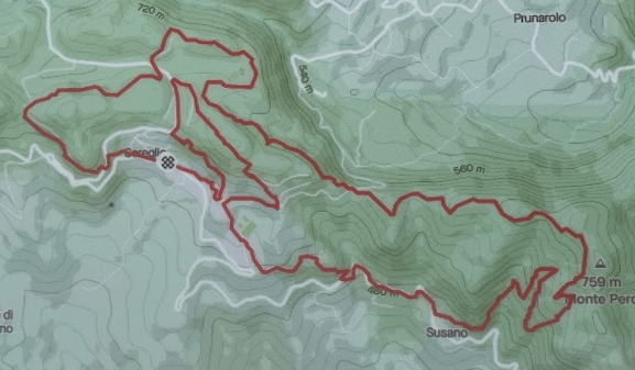
GREEN RUN 14KM +790 -790
Departure from the Totem Fontana in the town center towards Cavara. The next points will be the
panoramic road to get to the Sette Croci and the Serretto. Continuing towards I Laghi, you will take
the fitness trail to get to the Balzi and the famous Monte Pero. We will descend towards the village
of Susano then Bagarelli, Sant'Antonio, Monte Castagneto and return to the Totem from Via Vignola.
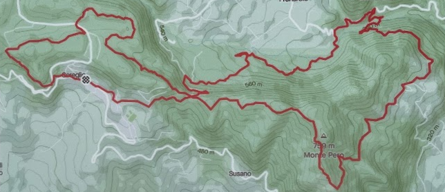
RED RUN 17KM +700 -700
Departure from the Totem Fontana in the town center towards Cavara. The next points will be the
panoramic road to get to the Sette Croci and the Serretto. Continuing towards I Laghi, you will take
the fitness trail to get to the Balzi and the famous Monte Pero. You will descend towards Liserna and
taking the Via dei Bisci you will reach the chestnut groves of Prunarolo, the lake of Ecchia,
Sant'Antonio and return to the Totem from the village of Suzzano.
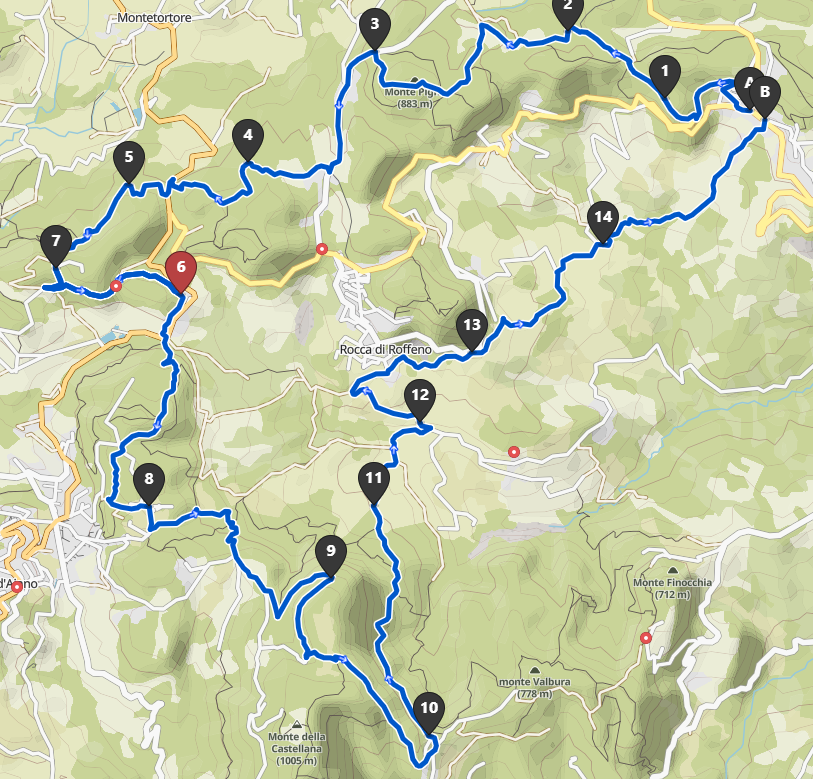
BLACK RUN 30KM +1500 -1500
Departure from the Totem Fontana in the town center towards Cavara. The next points will be the
panoramic road to get to the Seven Crosses. Continuing along Via Vedettola you will reach Santa
Lucia where you can taste the excellent products of the local dairy. Continuing along via Tavole you
will reach Bocca dei Ravari and walking along a stretch of the Gothic Line you will arrive at the
splendid village of Torre Jussi. Continue in the direction of the Monti to arrive at Monte di Labante
and via the "Americani" path you reach the characteristic church of Roffeno. Short ups and downs
towards the splendid Pieve di Roffeno to go up towards Cereglio along Via degli Angeli and Via delle
Viole.
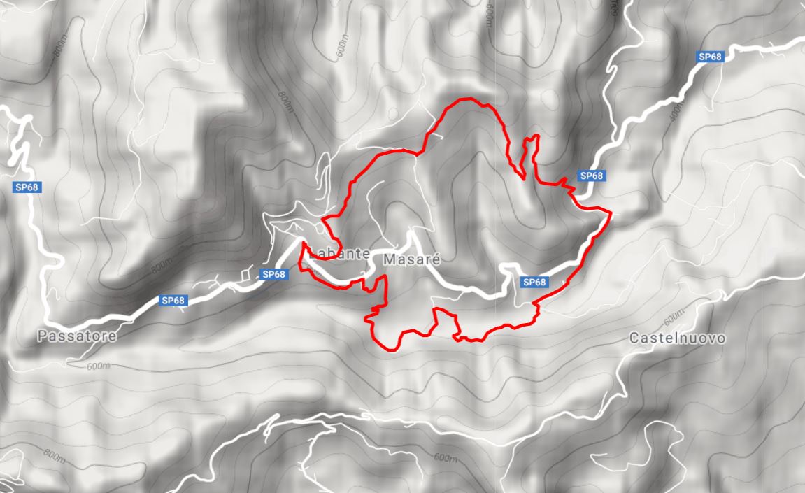
ANELLO DI LABANTE 8KM +550M -550M
The Caves of San Cristoforo di Labante are cavities that develop inside a large, particularly scenic
travertine flow which sees a high waterfall on the top among moss and lush plants. We are a few
kilometres from Vergato, in the valley of the Aneva torrent and from here, after visiting and
admiring this incredible naturalistic site, we pack our backpack and walk towards the valley. The CAI
162 path soon takes us onto the asphalt road near the church of Santa Maria di Labante, we skirt it
and take the path again towards the valley as far as the bed of the Aneva torrent. We cross it near
the ruins of the Mill of Santo Stefano and always keeping to the white road we soon reach a small
group of houses, the Abbey of Labante. The CAI 162 path continues to the right, we cross a field and
after a few minutes we reach Povolo with its beautiful mill kept in perfect state of conservation. If
the owner is present, she will be happy to show you the inside of the structure in which a small
exhibition of ancient tools is set up and from a trap door on the floor it is possible to observe the
control blades of the millstones which are still perfectly functional. We get back on the road, we
follow the CAI 152a trail sign up to the asphalted road in La Torrazza which we keep up to a hairpin
bend; here the path continues uphill (Sentiero delle Tane) where we will come across various natural
cavities dug into the rock. The climb ends at the Serretti, a pleasant place where we can observe
curious sandstone monoliths, at the base of which, on a soft carpet of grass, we can rest. We get
back on the road up to the Serretti di Sopra, we keep to the left (CAI trail sign 152) and then to the
right at a second crossroads. We reach Riola di Labante, skirting the abandoned Stella Mattutina
Mountain colony, hoping that the structure will soon be restored before neglect can damage it
further. We follow the paved road downhill and after a few meters we take the path to the left
which will quickly take us back to the starting point.
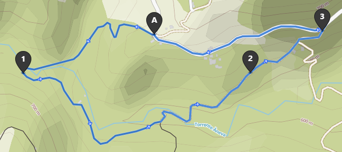
CASCATE DELL’ANEVA 3KM +100M -100M
This walk will allow you to admire the hidden pearl of the waterfalls of the Aneva stream. Arriving at
the small church of the Passatore, descend towards the stream along the CAI path 182, after passing
the cool Aneva stream, continue towards Mulino di Tinazzolo and Libraga, always skirting the
stream. Taking the CAI 182b variant it will be possible to go up to the provincial road 68 which will
take you back to the starting point, in Passatore.
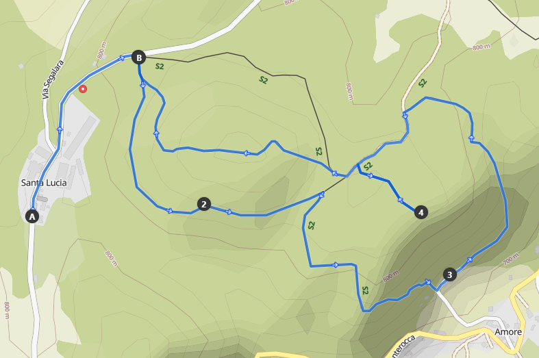
MONTE PIGNA 5KM +200M -160M
Monte Pigna is located on the route of the ancient Via Francigena called "Piccola Cassia". In this
section, the historic route coincides with the CAI 201 trail. It is also possible to reach the top of
Monte Pigna, at an altitude of 883 meters above sea level, by taking the 201/A variant, along a
pleasant trail that crosses chestnut woods and of oak. The history of Monte Pigna is mainly linked to
the Second World War and the Gothic Line. With funding from the G.A.L. In the Bolognese
Apennines, an experimental laboratory of naturalistic engineering was recently built in this area with
four didactic-illustrative stations, dedicated to the presentation of the different types of intervention
for mounted defence of the territory. At the picnic area it will be possible to observe the source of
the Samoggia river.